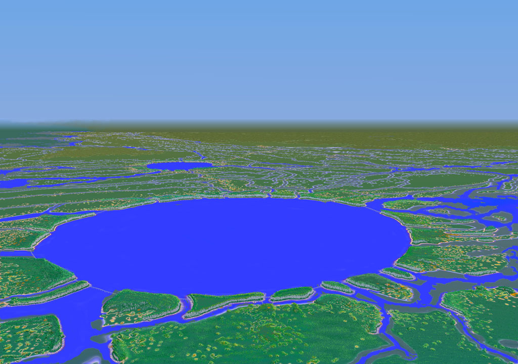
This picture was taken from about ten miles south of the Ring and about five miles above. We are looking just about due north. The edge of the Myassa is visible on the left, farms of the basin floor are in the distance. It is rare that the sky of Trenst is so cloudless, especially over the Myassa. This picture was taken in 3818 when the old causeway bridges were all down and only the new crystal bridges span the channels entering the ring.
Image courtesy Hostra Tours.